
Thank you for supporting this site ❤️
Make a donation
Make a donation
Al Amerat topographic map
Click on the map to display elevation.
Thank you for supporting this site ❤️
Make a donation
Make a donation
About this map
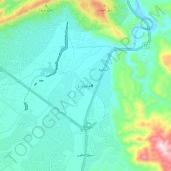
Name: Al Amerat topographic map, elevation, terrain.
Location: Al Amerat, Muscat Governorate, Oman (23.48234 58.46024 23.56234 58.54024)
Average elevation: 178 m
Minimum elevation: 37 m
Maximum elevation: 748 m
Thank you for supporting this site ❤️
Make a donation
Make a donation
Other topographic maps
Click on a map to view its topography, its elevation and its terrain.