
Thank you for supporting this site ❤️
Make a donation
Make a donation
Hennersberg topographic map
Click on the map to display elevation.
Thank you for supporting this site ❤️
Make a donation
Make a donation
About this map
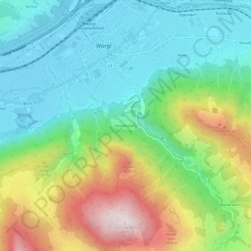
Name: Hennersberg topographic map, elevation, terrain.
Location: Hennersberg, Wörgl, Bezirk Kufstein, Tirol, 6300, Österreich (47.45452 12.04894 47.49452 12.08894)
Average elevation: 753 m
Minimum elevation: 496 m
Maximum elevation: 1,285 m
Thank you for supporting this site ❤️
Make a donation
Make a donation