
Montmartre topographic map
Interactive map
Click on the map to display elevation.
About this map
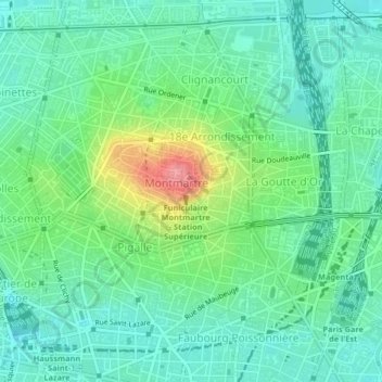
Name: Montmartre topographic map, elevation, terrain.
Average elevation: 63 m
Minimum elevation: 35 m
Maximum elevation: 135 m
Other topographic maps
Click on a map to view its topography, its elevation and its terrain.
Parijs
Frankrijk > Île-de-France > Parijs
Parijs, Île-de-France, Metropolitaans Frankrijk, Frankrijk
Average elevation: 62 m