
Thank you for supporting this site ❤️
Make a donation
Make a donation
Hüttenrode topographic map
Click on the map to display elevation.
Thank you for supporting this site ❤️
Make a donation
Make a donation
About this map
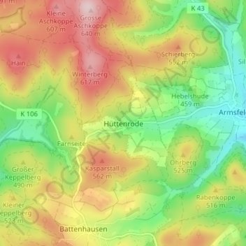
Name: Hüttenrode topographic map, elevation, terrain.
Average elevation: 488 m
Minimum elevation: 361 m
Maximum elevation: 632 m
Thank you for supporting this site ❤️
Make a donation
Make a donation