
Mittenwalde topographic map
Interactive map
Click on the map to display elevation.
About this map
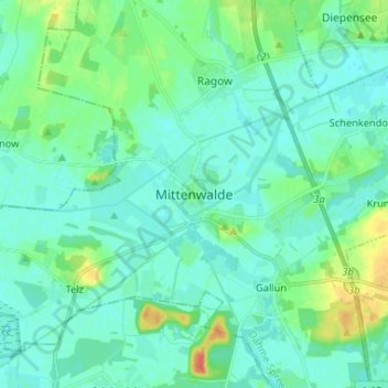
Name: Mittenwalde topographic map, elevation, terrain.
Location: Mittenwalde, Dahme-Spreewald, Brandenburg, 15749, Deutschland (52.22422 13.49606 52.30422 13.57606)
Average elevation: 43 m
Minimum elevation: 34 m
Maximum elevation: 74 m