
Zitácuaro topographic map
Interactive map
Click on the map to display elevation.
About this map
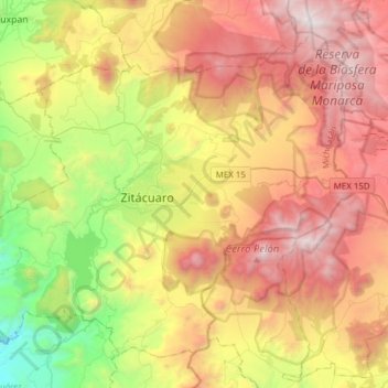
Name: Zitácuaro topographic map, elevation, terrain.
Location: Zitácuaro, Michoacán, 61500, México (19.31467 -100.48412 19.55793 -100.17672)
Average elevation: 2,318 m
Minimum elevation: 1,140 m
Maximum elevation: 3,614 m
Other topographic maps
Click on a map to view its topography, its elevation and its terrain.