
Triana topographic map
Interactive map
Click on the map to display elevation.
About this map
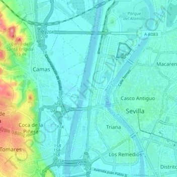
Name: Triana topographic map, elevation, terrain.
Location: Triana, Séville, Andalousie, Espagne (37.36735 -6.02495 37.42403 -5.98926)
Average elevation: 21 m
Minimum elevation: -3 m
Maximum elevation: 121 m
Other topographic maps
Click on a map to view its topography, its elevation and its terrain.
Distrito Cerro-Amate
Espagne > Andalousie > Séville
Rochelambert, Distrito Cerro-Amate, Séville, Andalousie, Espagne
Average elevation: 17 m