
Oxnard topographic map
Interactive map
Click on the map to display elevation.
About this map
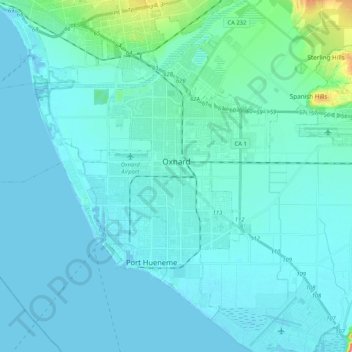
Name: Oxnard topographic map, elevation, terrain.
Location: Oxnard, Ventura County, Californie, États-Unis d'Amérique (34.11932 -119.32922 34.26147 -119.11970)
Average elevation: 16 m
Minimum elevation: -1 m
Maximum elevation: 179 m
Other topographic maps
Click on a map to view its topography, its elevation and its terrain.
Westlake Island
États-Unis d'Amérique > Californie > Ventura County > Thousand Oaks > Westlake Village
Westlake Island, Westlake Village, Thousand Oaks, Ventura County, CAL Fire Southern Region, Californie, États-Unis d'Amérique
Average elevation: 289 m
Thousand Oaks
États-Unis d'Amérique > Californie > Ventura County > Thousand Oaks
Thousand Oaks, Ventura County, Californie, 91362, États-Unis d'Amérique
Average elevation: 288 m