
Schloss Wiesenburg topographic map
Interactive map
Click on the map to display elevation.
About this map
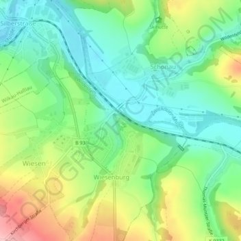
Name: Schloss Wiesenburg topographic map, elevation, terrain.
Average elevation: 337 m
Minimum elevation: 281 m
Maximum elevation: 436 m
Other topographic maps
Click on a map to view its topography, its elevation and its terrain.
Schloss Wildenfels
Deutschland > Sachsen > Wildenfels
Schloss Wildenfels, Schlossstraße, Wildenfels, Zwickau, Sachsen, Langenweißbach, 08134, Deutschland
Average elevation: 362 m
Aschberg
Deutschland > Sachsen > Wildenfels
Aschberg, Wildenfels, Zwickau, Sachsen, 08134, Deutschland
Average elevation: 342 m