
Lenggenwil topographic map
Interactive map
Click on the map to display elevation.
About this map
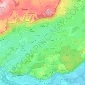
Name: Lenggenwil topographic map, elevation, terrain.
Average elevation: 576 m
Minimum elevation: 481 m
Maximum elevation: 736 m
Other topographic maps
Click on a map to view its topography, its elevation and its terrain.
Züberwangen
Schweiz > Sankt Gallen > Wahlkreis Wil
Züberwangen, Zuzwil (SG), Wahlkreis Wil, Sankt Gallen, 9523, Schweiz
Average elevation: 567 m