
Thank you for supporting this site ❤️
Make a donation
Make a donation
Eure topographic map
Click on the map to display elevation.
Thank you for supporting this site ❤️
Make a donation
Make a donation
About this map
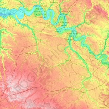
Name: Eure topographic map, elevation, terrain.
Location: Eure, Normandy, Metropolitan France, France (48.66642 0.29616 49.48482 1.80286)
Average elevation: 141 m
Minimum elevation: -3 m
Maximum elevation: 331 m
Thank you for supporting this site ❤️
Make a donation
Make a donation