
Pontiac topographic map
Interactive map
Click on the map to display elevation.
About this map
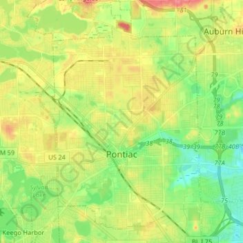
Name: Pontiac topographic map, elevation, terrain.
Average elevation: 290 m
Minimum elevation: 260 m
Maximum elevation: 329 m
Other topographic maps
Click on a map to view its topography, its elevation and its terrain.
Oakland County
Vereinigte Staaten von Amerika > Michigan > Oakland County
Oakland County, Michigan, Vereinigte Staaten von Amerika
Average elevation: 282 m
Bloomfield Township
Vereinigte Staaten von Amerika > Michigan > Oakland County
Bloomfield Township, Oakland County, Michigan, Vereinigte Staaten von Amerika
Average elevation: 272 m