
Nationalpark Mols Bjerge topographic map
Interactive map
Click on the map to display elevation.
About this map
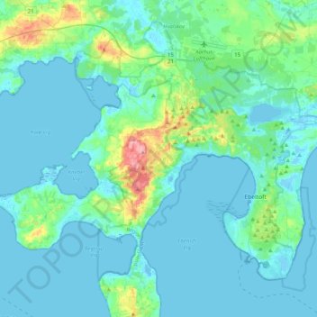
Name: Nationalpark Mols Bjerge topographic map, elevation, terrain.
Average elevation: 16 m
Minimum elevation: -4 m
Maximum elevation: 127 m
Other topographic maps
Click on a map to view its topography, its elevation and its terrain.
Jutland
Danemark > Jutland central > Jutland
Jutland, Ikast-Brande Kommune, Jutland central, Danemark
Average elevation: 11 m