
Brookline topographic map
Interactive map
Click on the map to display elevation.
About this map
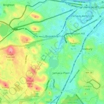
Name: Brookline topographic map, elevation, terrain.
Location: Brookline, Norfolk County, Massachusetts, United States (42.29459 -71.17894 42.35176 -71.10552)
Average elevation: 35 m
Minimum elevation: -2 m
Maximum elevation: 104 m