
Southern Nations topographic map
Interactive map
Click on the map to display elevation.
About this map
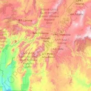
Name: Southern Nations topographic map, elevation, terrain.
Location: Southern Nations, Ethiopia (4.43883 34.18595 8.46049 38.71962)
Average elevation: 1,359 m
Minimum elevation: 361 m
Maximum elevation: 3,565 m
Other topographic maps
Click on a map to view its topography, its elevation and its terrain.
Chenna
Ethiopia > Southern Nations > Chenna
Chenna, Kaffa, Southern Nations, Ethiopia
Average elevation: 1,327 m