
Uttendorf topographic map
Interactive map
Click on the map to display elevation.
About this map
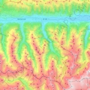
Name: Uttendorf topographic map, elevation, terrain.
Location: Uttendorf, Bezirk Zell am See, Salzburg, 5723, Oostenrijk (47.09986 12.52374 47.33063 12.68750)
Average elevation: 1,818 m
Minimum elevation: 753 m
Maximum elevation: 3,434 m