
San Martín topographic map
Interactive map
Click on the map to display elevation.
About this map
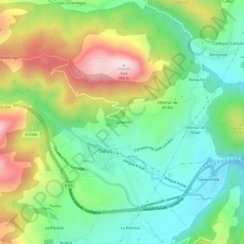
Name: San Martín topographic map, elevation, terrain.
Location: San Martín, Salas, Asturias, 33860, España (43.39288 -6.27316 43.43288 -6.23316)
Average elevation: 340 m
Minimum elevation: 140 m
Maximum elevation: 681 m
Other topographic maps
Click on a map to view its topography, its elevation and its terrain.
La Piniella
España > Asturias > Salas > La Estrada
La Piniella, La Estrada, Salas, Asturias, 33867, España
Average elevation: 314 m
Soto de los Infantes
Soto de los Infantes, Salas, Asturias, 33859, España
Average elevation: 430 m