
Thank you for supporting this site ❤️
Make a donation
Make a donation
Gramzow topographic map
Click on the map to display elevation.
Thank you for supporting this site ❤️
Make a donation
Make a donation
Gramzow
Zu Gramzow gehören die Ortsteile Gramzow, Lützlow, Meichow und Polßen sowie die Wohnplätze Ausbau, Forsthaus, Karlshof, Koboltenhof, Neumeichow, Randowhöhe und Zehnebeck.
Thank you for supporting this site ❤️
Make a donation
Make a donation
About this map
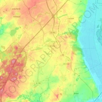
Name: Gramzow topographic map, elevation, terrain.
Average elevation: 59 m
Minimum elevation: 7 m
Maximum elevation: 116 m
Thank you for supporting this site ❤️
Make a donation
Make a donation