
Ellendale topographic map
Interactive map
Click on the map to display elevation.
About this map
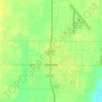
Name: Ellendale topographic map, elevation, terrain.
Location: Ellendale, Dickey County, North Dakota, 58436, United States (45.99158 -98.54014 46.02207 -98.50685)
Average elevation: 444 m
Minimum elevation: 431 m
Maximum elevation: 449 m
Other topographic maps
Click on a map to view its topography, its elevation and its terrain.
Wright Township
United States > North Dakota > Dickey County
Wright Township, Dickey County, North Dakota, United States
Average elevation: 425 m
Forbes
United States > North Dakota > Dickey County
Forbes, Dickey County, North Dakota, United States
Average elevation: 476 m