
Wesel topographic map
Interactive map
Click on the map to display elevation.
About this map
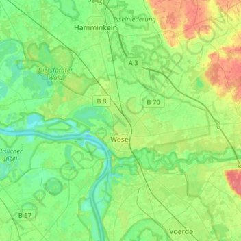
Name: Wesel topographic map, elevation, terrain.
Location: Wesel, Kreis Wesel, Renânia do Norte-Vestfália, Alemanha (51.61630 6.46031 51.72361 6.71373)
Average elevation: 26 m
Minimum elevation: 8 m
Maximum elevation: 63 m