
Daun topographic map
Interactive map
Click on the map to display elevation.
About this map
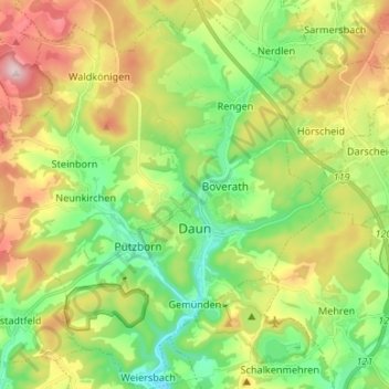
Name: Daun topographic map, elevation, terrain.
Location: Daun, Landkreis Vulkaneifel, Rheinland-Pfalz, 54550, Alemanha (50.16101 6.74411 50.24611 6.87554)
Average elevation: 485 m
Minimum elevation: 352 m
Maximum elevation: 696 m