
Paillote topographic map
Interactive map
Click on the map to display elevation.
About this map
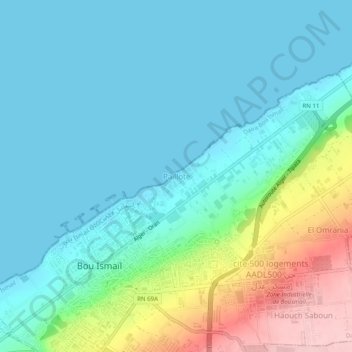
Name: Paillote topographic map, elevation, terrain.
Location: Paillote, Bou Ismaïl, Daïra Bou Ismaïl, Tipaza, 42415, Algérie (36.63291 2.68087 36.67291 2.72087)
Average elevation: 43 m
Minimum elevation: -1 m
Maximum elevation: 188 m
Other topographic maps
Click on a map to view its topography, its elevation and its terrain.
Haouch Saboun
Algérie > Tipaza > Daïra Bou Ismaïl > Bou Ismaïl
Haouch Saboun, Bou Ismaïl, Daïra Bou Ismaïl, Tipaza, 42015, Algérie
Average elevation: 140 m
Hamdania
Algérie > Tipaza > Daïra Bou Ismaïl > Bou Ismaïl
Hamdania, Bou Ismaïl, Daïra Bou Ismaïl, Tipaza, 42010, Algérie
Average elevation: 119 m