
Litermont topographic map
Interactive map
Click on the map to display elevation.
About this map
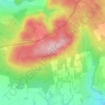
Name: Litermont topographic map, elevation, terrain.
Average elevation: 306 m
Minimum elevation: 209 m
Maximum elevation: 406 m
Der im Saarland gelegene Litermont ist ein Höhenzug von bis zu 414,2 m ü. NHN und erstreckt sich größtenteils in das Nalbacher Tal, mit kleineren Ausläufern bis nach Düppenweiler.