
La Croix Aux Moines topographic map
Interactive map
Click on the map to display elevation.
About this map
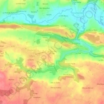
Name: La Croix Aux Moines topographic map, elevation, terrain.
Average elevation: 58 m
Minimum elevation: 12 m
Maximum elevation: 98 m
Other topographic maps
Click on a map to view its topography, its elevation and its terrain.
Saint-Barthélémy
France > Bretagne > Morbihan > Rochefort-en-Terre
Saint-Barthélémy, Rochefort-en-Terre, Vannes, Morbihan, Bretagne, France métropolitaine, 56220, France
Average elevation: 56 m