
Indostan topographic map
Interactive map
Click on the map to display elevation.
About this map
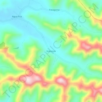
Name: Indostan topographic map, elevation, terrain.
Location: Indostan, Junín, Cantón Junín, Manabí, Ecuador (-0.94374 -80.17799 -0.90374 -80.13799)
Average elevation: 174 m
Minimum elevation: 41 m
Maximum elevation: 437 m