
Ungra topographic map
Interactive map
Click on the map to display elevation.
About this map
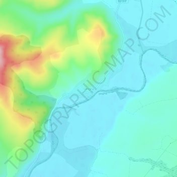
Name: Ungra topographic map, elevation, terrain.
Location: Ungra, Brașov, 507240, Rumanía (45.96168 25.24223 46.00168 25.28223)
Average elevation: 478 m
Minimum elevation: 437 m
Maximum elevation: 616 m