
Weseke topographic map
Interactive map
Click on the map to display elevation.
About this map
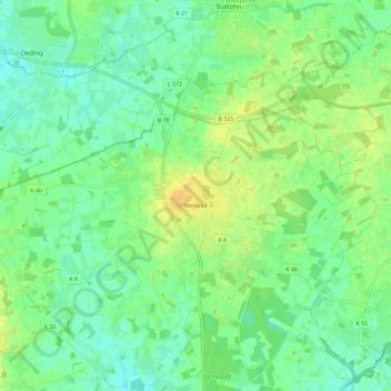
Name: Weseke topographic map, elevation, terrain.
Location: Weseke, Borken, Kreis Borken, Nordrhein-Westfalen, Deutschland (51.88793 6.79482 51.93287 6.90919)
Average elevation: 53 m
Minimum elevation: 43 m
Maximum elevation: 66 m