
Mount Sherman topographic map
Interactive map
Click on the map to display elevation.
About this map
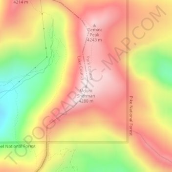
Name: Mount Sherman topographic map, elevation, terrain.
Average elevation: 3,989 m
Minimum elevation: 3,587 m
Maximum elevation: 4,278 m
Other topographic maps
Click on a map to view its topography, its elevation and its terrain.
Leadville
Vereinigte Staaten von Amerika > Colorado > Lake County > Leadville
Leadville, Lake County, Colorado, 80461, Vereinigte Staaten von Amerika
Average elevation: 3,106 m