
Thank you for supporting this site ❤️
Make a donation
Make a donation
Arlberg topographic map
Click on the map to display elevation.
Thank you for supporting this site ❤️
Make a donation
Make a donation
Arlberg
Der Arlberg ist ein verkehrstechnisch wichtiger, 1793 m ü. A. hoher Pass an der Grenze zwischen den österreichischen Bundesländern Vorarlberg und Tirol. Die Passhöhe selbst liegt vollständig auf Tiroler Gebiet. Mit dem Tourismus am Arlberg hat sich der Begriff auch als Marke für die Tourismusregion (vor allem als Wintersportgebiet) etabliert.
Thank you for supporting this site ❤️
Make a donation
Make a donation
About this map
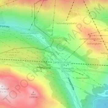
Name: Arlberg topographic map, elevation, terrain.
Average elevation: 1,962 m
Minimum elevation: 1,592 m
Maximum elevation: 2,410 m
Thank you for supporting this site ❤️
Make a donation
Make a donation