
Thank you for supporting this site ❤️
Make a donation
Make a donation
Dettenschwang topographic map
Click on the map to display elevation.
Thank you for supporting this site ❤️
Make a donation
Make a donation
Dettenschwang
Das Pfarrdorf Dettenschwang liegt circa sechs Kilometer westlich von Dießen am Ammersee auf einem Höhenrücken in einer eiszeitlichen Jungmoränenlandschaft.
Thank you for supporting this site ❤️
Make a donation
Make a donation
About this map
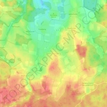
Name: Dettenschwang topographic map, elevation, terrain.
Average elevation: 675 m
Minimum elevation: 637 m
Maximum elevation: 706 m
Thank you for supporting this site ❤️
Make a donation
Make a donation