
Williams County topographic map
Interactive map
Click on the map to display elevation.
About this map
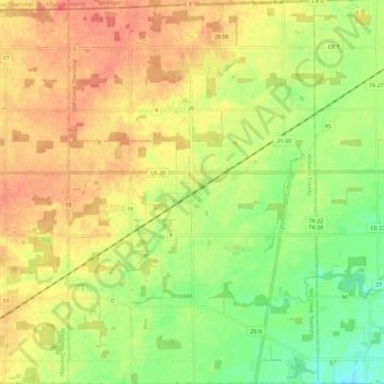
Name: Williams County topographic map, elevation, terrain.
Average elevation: 260 m
Minimum elevation: 230 m
Maximum elevation: 284 m
Other topographic maps
Click on a map to view its topography, its elevation and its terrain.
Bexley
United States of America > Ohio > Bexley
Bexley, Franklin County, Ohio, 43209, United States of America
Average elevation: 240 m
Niles
United States of America > Ohio > Niles
Niles, Trumbull, Ohio, 44446, United States of America
Average elevation: 280 m
Kelleys Island
United States of America > Ohio > Kelleys Island
Kelleys Island, Erie County, Ohio, 43438, United States of America
Average elevation: 179 m
Mentor-on-the-Lake
United States of America > Ohio > Mentor-on-the-Lake
Mentor-on-the-Lake, Lake County, Ohio, 44060, United States of America
Average elevation: 186 m
Montgomery County
United States of America > Ohio
Montgomery County, Ohio, United States of America
Average elevation: 277 m
Oakwood Village
United States of America > Ohio > Oakwood Village
Oakwood Village, Clark County, Ohio, 45503, United States of America
Average elevation: 319 m
Mosquito Creek
United States of America > Ohio
Mosquito Creek, Trumbull, Ohio, 44484, United States of America
Average elevation: 294 m
Norristown
United States of America > Ohio > Norristown
Norristown, East Township, Carroll County, Ohio, 44427:44651, United States of America
Average elevation: 359 m
Portsmouth
United States of America > Ohio > Portsmouth
Portsmouth, Scioto County, Ohio, United States of America
Average elevation: 211 m
Pottersburg
United States of America > Ohio > Pottersburg
Pottersburg, Allen Township, Union County, Ohio, United States of America
Average elevation: 331 m
Wellston
United States of America > Ohio > Wellston
Wellston, Jackson County, Ohio, 45692, United States of America
Average elevation: 235 m
Glouster
United States of America > Ohio > Glouster
Glouster, Athens County, Ohio, 45732, United States of America
Average elevation: 235 m
Kettering
United States of America > Ohio > Kettering
Kettering, Montgomery County, Ohio, United States of America
Average elevation: 275 m
Bridgeview Harbor
United States of America > Ohio > Cincinnati
Bridgeview Harbor, Cincinnati, Hamilton County, Ohio, 45228, United States of America
Average elevation: 178 m
Grand View
United States of America > Ohio > Hamilton > Grand View
Grand View, Hamilton, Butler County, Ohio, 45013, United States of America
Average elevation: 200 m
Hazelton
United States of America > Ohio > Youngstown > Hazelton
Hazelton, Youngstown, Mahoning, Ohio, 44506, United States of America
Average elevation: 293 m
Ryan
United States of America > Ohio > Toledo > Ryan
Ryan, Toledo, Lucas County, Ohio, 43603, United States of America
Average elevation: 185 m
Grandview Heights
United States of America > Ohio > Grandview Heights
Grandview Heights, Franklin County, Ohio, United States of America
Average elevation: 232 m
Bay Village
United States of America > Ohio > Bay Village
Bay Village, Cuyahoga County, Ohio, 44140, United States of America
Average elevation: 185 m