
Xermade topographic map
Interactive map
Click on the map to display elevation.
About this map
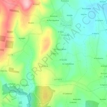
Name: Xermade topographic map, elevation, terrain.
Location: Xermade, A Silva, Lugo, Galicia, 27826, España (43.32443 -7.83907 43.36443 -7.79907)
Average elevation: 502 m
Minimum elevation: 430 m
Maximum elevation: 627 m
Other topographic maps
Click on a map to view its topography, its elevation and its terrain.