
Lurgan topographic map
Interactive map
Click on the map to display elevation.
About this map
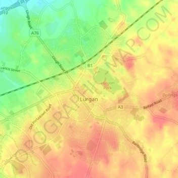
Name: Lurgan topographic map, elevation, terrain.
Location: Lurgan, County Armagh, Northern Ireland, United Kingdom (54.44378 -6.37463 54.48257 -6.30218)
Average elevation: 48 m
Minimum elevation: 15 m
Maximum elevation: 70 m