
Thank you for supporting this site ❤️
Make a donation
Make a donation
hydrology topographic map
Click on the map to display elevation.
Thank you for supporting this site ❤️
Make a donation
Make a donation
About this map
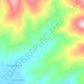
Name: hydrology topographic map, elevation, terrain.
Location: hydrology, Anelghowhat, Tafea, Vanuatu (-20.23509 169.78888 -20.19995 169.81113)
Average elevation: 173 m
Minimum elevation: 0 m
Maximum elevation: 466 m
Thank you for supporting this site ❤️
Make a donation
Make a donation