
Thank you for supporting this site ❤️
Make a donation
Make a donation
Ambadandegama topographic map
Click on the map to display elevation.
Thank you for supporting this site ❤️
Make a donation
Make a donation
About this map
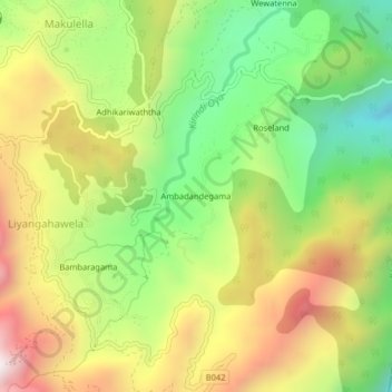
Name: Ambadandegama topographic map, elevation, terrain.
Location: Ambadandegama, Badulla District, Uva Province, Sri Lanka (6.79643 81.02380 6.83643 81.06380)
Average elevation: 1,223 m
Minimum elevation: 759 m
Maximum elevation: 1,772 m
Thank you for supporting this site ❤️
Make a donation
Make a donation