
La Clusaz topographic map
Interactive map
Click on the map to display elevation.
About this map
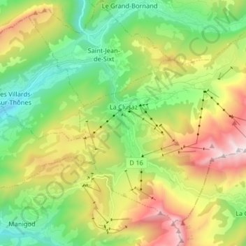
Name: La Clusaz topographic map, elevation, terrain.
Average elevation: 1,377 m
Minimum elevation: 720 m
Maximum elevation: 2,495 m
L'argument altitude (valeur 1040 m) n'existe pas dans le modèle appelé
Other topographic maps
Click on a map to view its topography, its elevation and its terrain.
Col des Aravis
France > Auvergne-Rhône-Alpes > La Clusaz
Col des Aravis, Route du Col des Aravis (route des Grandes Alpes), La Grande Montagne, La Clusaz, Annecy, Haute-Savoie, Auvergne-Rhône-Alpes, France métropolitaine, 74220, France
Average elevation: 1,667 m