
Rybníček topographic map
Interactive map
Click on the map to display elevation.
About this map
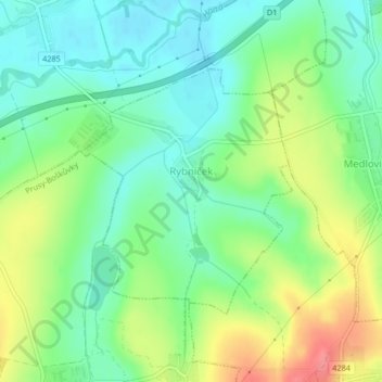
Name: Rybníček topographic map, elevation, terrain.
Location: Rybníček, okres Vyškov, Jihomoravský kraj, Southeast, Czechia (49.26373 17.06177 49.28111 17.08476)
Average elevation: 250 m
Minimum elevation: 222 m
Maximum elevation: 299 m