
Rigi Hochflue topographic map
Interactive map
Click on the map to display elevation.
About this map
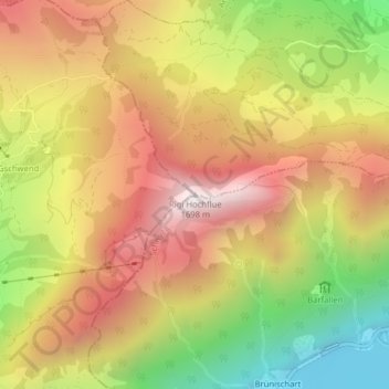
Name: Rigi Hochflue topographic map, elevation, terrain.
Location: Rigi Hochflue, Lauerz, Schwyz, 6424, Schweiz (47.01018 8.55988 47.01028 8.55998)
Average elevation: 1,090 m
Minimum elevation: 423 m
Maximum elevation: 1,656 m