
La Reid topographic map
Interactive map
Click on the map to display elevation.
About this map
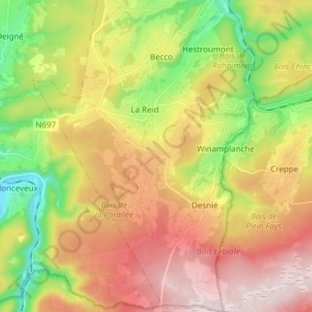
Name: La Reid topographic map, elevation, terrain.
Location: La Reid, Theux, Verviers, Liège, Wallonie, 4910, Belgique (50.43364 5.73872 50.51652 5.83108)
Average elevation: 348 m
Minimum elevation: 143 m
Maximum elevation: 563 m
Other topographic maps
Click on a map to view its topography, its elevation and its terrain.