
Goris topographic map
Interactive map
Click on the map to display elevation.
About this map
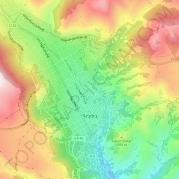
Name: Goris topographic map, elevation, terrain.
Location: Goris, Գորիսի տարածաշրջան, Provinz Sjunik, Armenien (39.49195 46.31325 39.52979 46.35320)
Average elevation: 1,513 m
Minimum elevation: 1,210 m
Maximum elevation: 1,865 m