
Littleton topographic map
Interactive map
Click on the map to display elevation.
About this map
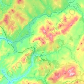
Name: Littleton topographic map, elevation, terrain.
Location: Littleton, Grafton County, New Hampshire, United States (44.27124 -71.98454 44.40667 -71.69669)
Average elevation: 360 m
Minimum elevation: 176 m
Maximum elevation: 730 m
Other topographic maps
Click on a map to view its topography, its elevation and its terrain.
North Littleton
United States > New Hampshire > Grafton County > Littleton > North Littleton
North Littleton, Littleton, Grafton County, New Hampshire, United States
Average elevation: 333 m