
Ban Wang Kloi topographic map
Interactive map
Click on the map to display elevation.
About this map
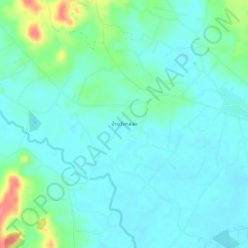
Name: Ban Wang Kloi topographic map, elevation, terrain.
Location: Ban Wang Kloi, Ban Pak Don, Rayong Province, Thailand (12.67719 101.56856 12.71719 101.60856)
Average elevation: 17 m
Minimum elevation: 0 m
Maximum elevation: 80 m