
Huisduinen topographic map
Interactive map
Click on the map to display elevation.
About this map
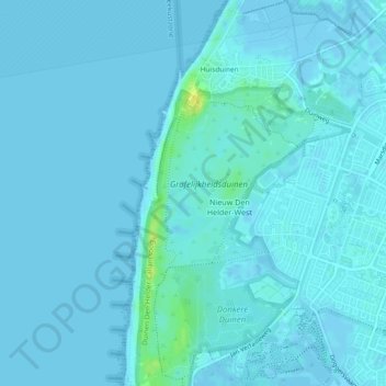
Name: Huisduinen topographic map, elevation, terrain.
Location: Huisduinen, Den Helder, Noord-Holland, Nederland (52.92998 4.71295 52.95808 4.74113)
Average elevation: 2 m
Minimum elevation: -4 m
Maximum elevation: 19 m
Other topographic maps
Click on a map to view its topography, its elevation and its terrain.
Den Helder
Nederland > Noord-Holland > Den Helder
Den Helder, Noord-Holland, Nederland
Average elevation: 0 m