
Padang Lawas topographic map
Interactive map
Click on the map to display elevation.
About this map
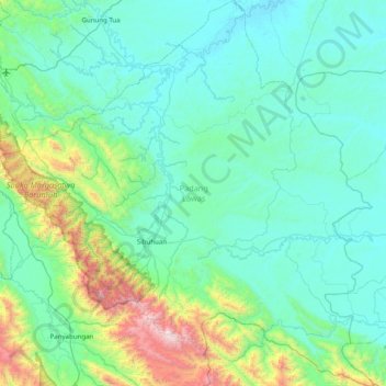
Name: Padang Lawas topographic map, elevation, terrain.
Location: Padang Lawas, Sumatera Utara, Sumatra, 22774, Indonesia (0.75667 99.41894 1.54870 100.18639)
Average elevation: 341 m
Minimum elevation: 28 m
Maximum elevation: 2,168 m