
Sept-Îles topographic map
Interactive map
Click on the map to display elevation.
About this map
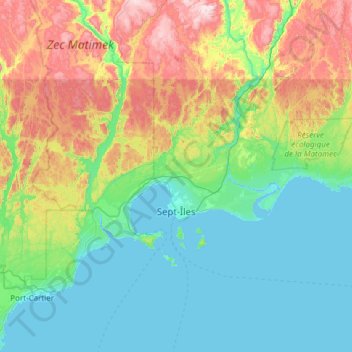
Name: Sept-Îles topographic map, elevation, terrain.
Location: Sept-Îles, Sept-Rivières, Côte-Nord, Quebec, Canada (50.07828 -66.72530 50.49399 -65.51313)
Average elevation: 189 m
Minimum elevation: -4 m
Maximum elevation: 802 m
Other topographic maps
Click on a map to view its topography, its elevation and its terrain.
Matamec
Canada > Quebec > Sept-Rivières > Sept-Îles
Matamec, Sept-Îles, Sept-Rivières, Côte-Nord, Quebec, Canada
Average elevation: 19 m