
Altnau topographic map
Interactive map
Click on the map to display elevation.
About this map
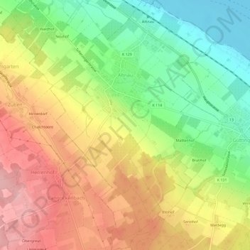
Name: Altnau topographic map, elevation, terrain.
Location: Altnau, Bezirk Kreuzlingen, Thurgau, 8595, Schweiz (47.58554 9.23880 47.62387 9.28105)
Average elevation: 472 m
Minimum elevation: 392 m
Maximum elevation: 552 m
Other topographic maps
Click on a map to view its topography, its elevation and its terrain.
Helsighausen
Schweiz > Thurgau > Bezirk Kreuzlingen > Raperswilen
Helsighausen, Raperswilen, Bezirk Kreuzlingen, Thurgau, 8558, Schweiz
Average elevation: 583 m
Tägerwilen
Schweiz > Thurgau > Bezirk Kreuzlingen
Tägerwilen, Bezirk Kreuzlingen, Thurgau, 8274, Schweiz
Average elevation: 490 m