
Thank you for supporting this site ❤️
Make a donation
Make a donation
Jefferson City topographic map
Click on the map to display elevation.
Thank you for supporting this site ❤️
Make a donation
Make a donation
About this map
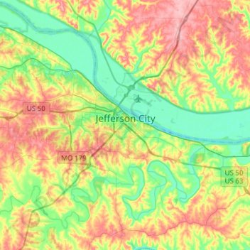
Name: Jefferson City topographic map, elevation, terrain.
Location: Jefferson City, Cole County, Missouri, United States (38.52469 -92.28755 38.61769 -92.03726)
Average elevation: 203 m
Minimum elevation: 156 m
Maximum elevation: 266 m
Thank you for supporting this site ❤️
Make a donation
Make a donation
Other topographic maps
Click on a map to view its topography, its elevation and its terrain.