
Harrold topographic map
Click on the map to display elevation.
About this map
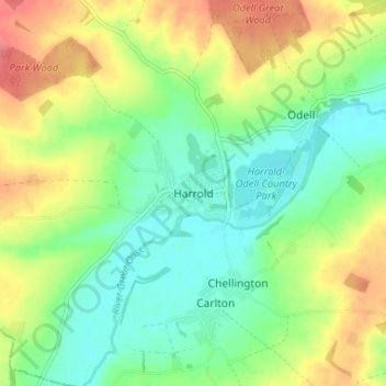
Name: Harrold topographic map, elevation, terrain.
Location: Harrold, Bedford, England, MK43 7DA, United Kingdom (52.18175 -0.62871 52.22175 -0.58871)
Average elevation: 66 m
Minimum elevation: 38 m
Maximum elevation: 108 m
Other topographic maps
Click on a map to view its topography, its elevation and its terrain.