
Thank you for supporting this site ❤️
Make a donation
Make a donation
Frades topographic map
Click on the map to display elevation.
Thank you for supporting this site ❤️
Make a donation
Make a donation
About this map
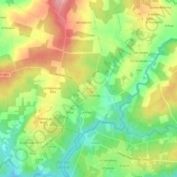
Name: Frades topographic map, elevation, terrain.
Location: Frades, Ordes, A Coruña, Galicien, 15686, Spanien (43.01524 -8.31277 43.05524 -8.27277)
Average elevation: 336 m
Minimum elevation: 274 m
Maximum elevation: 407 m
Thank you for supporting this site ❤️
Make a donation
Make a donation