
Valle topographic map
Interactive map
Click on the map to display elevation.
About this map
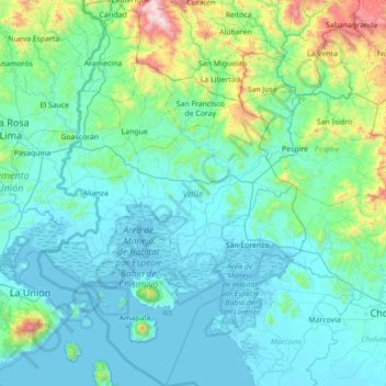
Name: Valle topographic map, elevation, terrain.
Location: Valle, Honduras (13.19726 -87.82166 13.85161 -87.34231)
Average elevation: 193 m
Minimum elevation: -1 m
Maximum elevation: 1,573 m
Other topographic maps
Click on a map to view its topography, its elevation and its terrain.